Huguenot Fort

 It's amazing how much history there is in your own background when you take the time to look. Today I went to one of those places, the Old Huguenot Fort in Oxford, MA.

Monument On Site

The town of Oxford was settled by the Huguenots around 1686. The Huguenots were French Protestants forced to flee France because of their religious beliefs and settled in London. They then came to Oxford to settle in Nipmuck Country.

Southwest Parapet

They built a fort on the top of a hill. This fort had a view of the surrounding countryside and was built to hold the families that had settled there. There was a tall stockade fence with two parapets, one on the northeast corner and one opposite on the southeast corner. Inside was a large blockhouse built with thick timbers. This was used for protection from the Indians. On August 25, 1696, a party of hostile Indians went into the home of the Johnson family and brutally murdered the three children. Soon after this, the settlement was abandoned.

South Wall Looking East

I was surprised at how big the fort was. I was expecting a smaller area. I haven't been able to ascertain if the stones that outline the fort are original. I don't think so. 

Stockade Cellar Hole

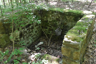
Although the area was covered with a few inches of snow, I could locate the well and the cellarhole of the main stockade.

Well

I will return in the spring to see what else might be found at this location. There is something about walking on the ground where you know 339 years ago people lived and unfortunately lived in fear.


The Boston Turnpike Part 2

 I returned to the Boston Turnpike to explore the eastern section. I was unable to cross Bigelow Brook to continue my first trip but I was able to access it from the other side, sort of.

There is a trail called "The Boston Turnpike Greenway" that is accessible from Rte 198 in Eastford. There is a pull off at the junction of 198 and 244. The trail begins in the woods next to the driveway. The driveway is actually a piece of the old road. The trail is marked with white blazes. The trail splits very close to the beginning. I missed the split and the trail took me on a loop to the west end of the turnpike. I should have taken a right and this takes you directly to the roadbed in about 100 feet. The loop section is very interesting in its own right.


A plaque explaining the history of the Boston Turnpike is posted on the trail. Had I hiked this section first, my last post would have been correct. 


As you can see this is the same wall that we saw on the other side of the brook. As I mentioned, one of the identifying features of these old turnpikes is the parallel walls along the road. Another consistent feature is the width of the road. 30 to 50 feet wide. 

This picture is what remains of a culvert. I don't think there was a major bridge here, probably a large, flat stone or just some thick wooden planks. 


The above marker depicts the number of miles to Hartford. These were placed every mile along the route and were used to calculate the tolls. I don't know if this is original. This is the only one I have seen but I have come across markers along old Boston Post Road and they are not as "nice". 

This is the remains of another culvert. This one is topped with several large, flat, stones. 
This picture is of a dead tree. Can you imagine what this tree has seen?

This section of the turnpike is about a mile long from end to end. You cannot follow it all the way to Bigelow Brook. That end is posted. I would have liked to have seen if there were any remains of a bridge on that end. 

One thing of interest to me is I never come across old ruins along these turnpikes. Well almost never. I did come across an old cistern along a section of Turnpike in Dudley.

I don't know why this is. The turnpikes mostly followed old roads that were already established between farms. These could have been built between farms and at the back of the properties. The area was not heavily populated when these roads were built. When the roads came to a town this is where the building would have been. 

Looking at the Boston Turnpike on satellite images you can see most of the towns it traveled through are now pretty built up. There does not appear to be any original buildings from when the turnpike was operational.  

If you are interested in old roads, this is a good example of one in it's original condition.

The Old Connecticut Path Part 2

Today, I returned to the Old Connecticut Path, the same place I wrote about two posts ago . Since my last trip there didn’t work out well, I...